Podcast: Play in new window | Download
Subscribe: Apple Podcasts | Spotify | TuneIn
LANDED Podcast 038
Fito Alvarado – Copan Archaeological Site Guide
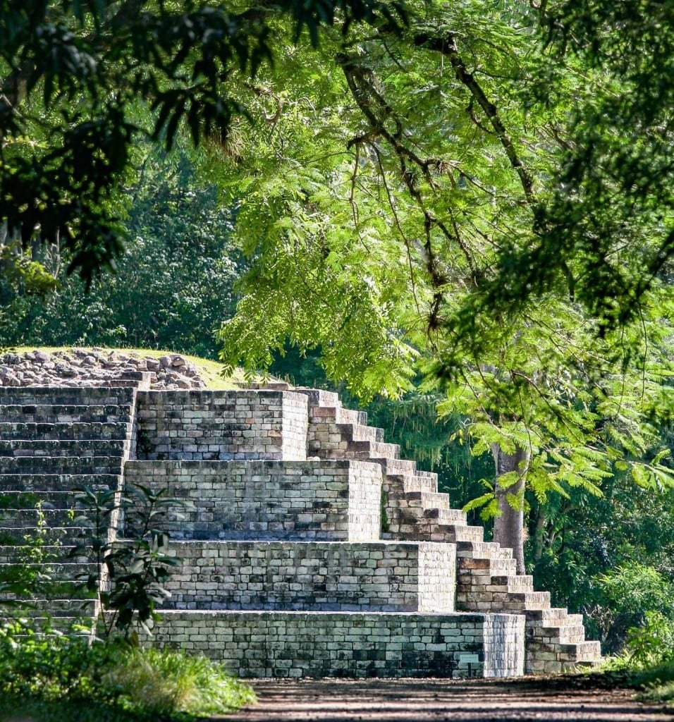
Fito Alvarado was born in a small town of western Honduras, within the ruins of the world-famous Maya archaeological site of Copan. His father was a truck driver, and his mother was a cook at the only tourist hotel in town. Fito spent his childhood playing between the ruins of this ancient Maya kingdom.
Over the years, he has witnessed many of the discoveries made during the excavations at the site. At age 15 he began guiding visitors of the ruins on weekends. Those interactions helped him learn English.
After completing high school Fito studied at IBM Honduras, graduating with accreditations in computer programming and software design. He began studies in industrial engineering at the national University at Tegucigalpa. On school breaks he traveled home to continue guiding at the Maya ruins. That contrast made clear that his passions were Maya culture and the natural world. He left the capital to dedicate his life to guiding.
Fito has trained in tourism, nature, archaeology and history. He has a gift for language, and is conversant in English, Spanish and Italian. His work has taken him site across the Maya world, from Mexico to Panama.

Rather read than listen?
Find the transcript below
Fito Alvarado, it’s so good to talk to you again.
Nice to hear from you, John. A pleasure.
Do you know it was 20 years ago that I met you in Copán?
Is it hard to believe? Time flies.
Yes, hard to believe. I was looking at pictures of the time that we brought our girls to Copán. The oldest one is married now.
Wow, time flies. Oh my god.
Yeah. Fito, you’re from Copán Ruinas.
Yes, you’re right. I’m from Copán. I was born and raised here.
I love that town.
Yeah, me too. It’s a nice town.
When I met you, we did a tour together. We started in Quiriguá, and then we went to Copán.
I remember that. Normally the two sites are visited together, Quiriguá and Copán.
I have great memories of Copán. What makes it so special for you as a native?
Well, there’s so much about it. The fact that Copán is the southernmost of the Maya, but it’s also the southernmost border of Mesoamerica, which is this cultural region grouping all the maize-farming, the corn-farming societies of this part of the world. Copán, for instance, in the past, the Maya of Copán were the only ones that were able to interact with non-Maya, but they were able also to interact with non-maize farmers who were making a life mostly out of hunting and gathering. And some of them that had a little bit of agriculture were growing root crops rather than maize. And this is very interesting because the Maya of the rest of the lands never had that interaction with anybody different, but only Mesoamericans or Mayans around them. So that makes Copán very special, and we still have some of those cultural characteristics and differences with the neighbors in the rest of Honduras. We notice it even today. So imagine far back during the Classic Maya, that was more accentuated than today.
Were those Lenca people?
Yes, some of them are what we call Lenca today. Most of those people were interacting with the Maya and trying to copy some of the things the Maya did. For instance, in some of their pottery, we can see details that try to imitate Maya iconography, but in reality it’s not Maya, or some kind of glyphs that look like Maya glyphs, but they are not Maya glyphs. Copán and the Maya were like the big superpowers at that time in this part of Honduras. So the rest of the people were from different linguistic families. Maybe the most dominant today in the rest of Honduras and a big part of the north of El Salvador is what we call the Lenca.
And if I remember right, there is evidence on site that Copán interacted with Tikal and probably with El Mirador.
Yes, Copán and Tikal had a very interesting relationship. It’s archaeologically proven that the Copán monarchic system was established by the Tikal royal family. Archaeological evidence points out Copán like a younger brother of Tikal. It is possible that back at that time Tikal was trying to stretch its control. Maybe in this area the major attraction was to control the areas where jade was extracted. So Copán is different to the rest of the Maya world because most of the Maya cities you see in the Classic period were settled in the base of the Yucatán Peninsula or in the Yucatán Peninsula itself, so there’s a lot of limestone. But there were no volcanic stones that were needed at that time for their tool making or jewelry making, like obsidian and jade.
Right, obsidian and jade.
So we have nearby obsidian quarries and also jade quarries in what is eastern Guatemala today, relatively close to Copán. So probably that was motivating the elite of Tikal to execute some control of this part of the Maya world, with Copán being so far south.
So the time period of Copán…
All the Copán monarchic system is taking place within the Maya Classic period, between 250 AD up to 900 AD. But the Copán monarchy itself runs from around 420 AD to around 820 or 822 AD. So let me say that the monarchy of Copán lasted around 400 years. Although there is archaeological evidence showing permanent occupation of Copán dating far back to 1500 BC, in a time when the communities that were settled here were those hunters and gatherers transitioning into agriculture, probably a very early stage of discovering agriculture in this part of the Maya world.
And that was primarily maize.
Maize was the main element through the success of this culture. But in that very early stage, they were domesticating other plants as well. Probably one of the very first plants to be domesticated was maize, some sort of proto-beans, and some types of squashes. But there were others that were very helpful for them. One of them is the calabash or the gourd tree. That was probably one of the very first ones to be domesticated as well. And very often the gourd tree appears in the iconography of Maya mythology.
I’m curious, being a border region, do we find evidence that the people of Copán traded crops or plants that came all the way from South America, like cacao?
Not from South America. Perishable materials, grain for instance, would be very hard to trade over far distances since the transportation technology of the Maya was basically walking or dugout canoeing when possible. But there are certain objects that were found in Copán that prove contact with far south in Central America. Some of those pieces were little pieces of gold that were here for a little while on display in a little museum, but they were robbed from the museum.
Oh, Fito. Being from Copán, do you feel a family connection to this culture?
Definitely, yes. Part of my ancestry was Maya from here, ***Maya Ch’orti’***, but part of my family was of Spanish origin. So my family is mestizo. My grandfather used to be one of the workers in the archaeological project. So I was visiting the site every week. He used to teach all of his grandchildren about the ruins, and he proudly made sketches of things and told us stories about the site. So yeah, we grew up understanding that that is like our ancient home.
When was the Copán Park created?
The Copán archaeological site comes out officially back in 1952. That was the time most of the major archaeological projects were finishing and restoring the temples and trying to stabilize most of the infrastructure. When the institutions handed over the project—in this case it was the Carnegie archaeological project—they decided to hand the site officially to the government of Honduras. For that purpose, the government of Honduras created an institute, the Institute of Anthropology and History, to protect the site of Copán and also protect all the rest of the historical monuments of the country. And that’s the time, 1952, when the Copán archaeological site came to life as a protected area.
Was your grandfather involved in the creation of the park?
My grandfather was part of the working staff at that time. What happened too is that most of those people who were working in the excavation processes were hired by the Institute of Anthropology to continue protecting the site as guards. That was one of the suggestions of the archaeological mission in order to create sustainability: they said, “You should incorporate the people who were working at the site. Let’s give them the job of protecting it now.”
So you grew up learning about the site, visiting there, spending time with your family, and it’s right outside of town. I mean, it’s a 10-minute walk from the center of town.
The main archaeological site is half a mile from town. But what was discovered, John, is that the archaeological site that was first protected back in 1952 was only the center of the ancient city. As mapping projects started and people began to report the existence of ruined buildings on their properties, we started little by little to understand that the city in the past was actually occupying the totality of the valley, occupying the hilltops and the areas where modern town of Copán is built now. So we realized that the city in the past was actually bigger than the town today.
Were any of the buildings in town, like maybe the church, built on top of Maya structures?
Yes, you’re right. The church that was originally built in the middle of town was originally only mud with a thatch roof. There was a British explorer, Maudslay, who documented that part of a Maya altar was embedded in the main altar of that early church. Little by little, that mud-wall church was rebuilt and made larger, and for that purpose they used building materials from the temples that were adjacent. Some of that can be seen today when you’re looking at the main church in town. Facing it to the left-hand side, just around the corner on the left, there is a little piece of plaster missing and you can see the stone walls that are the same stone blocks of ancient Maya temples. The architect who remodeled the church decided to leave it like that as a “window to the past,” she said.
So the main site that was discovered and protected in the early 1950s, that’s where we go now to see the Rosalila temple, the stelae, the hieroglyphic staircase.
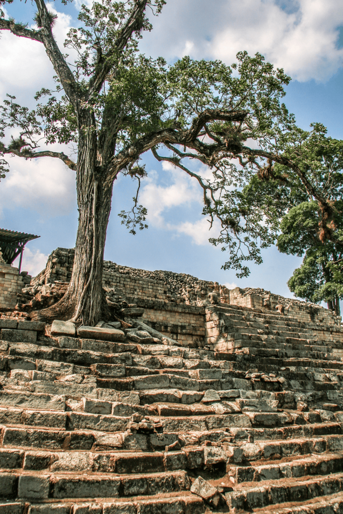
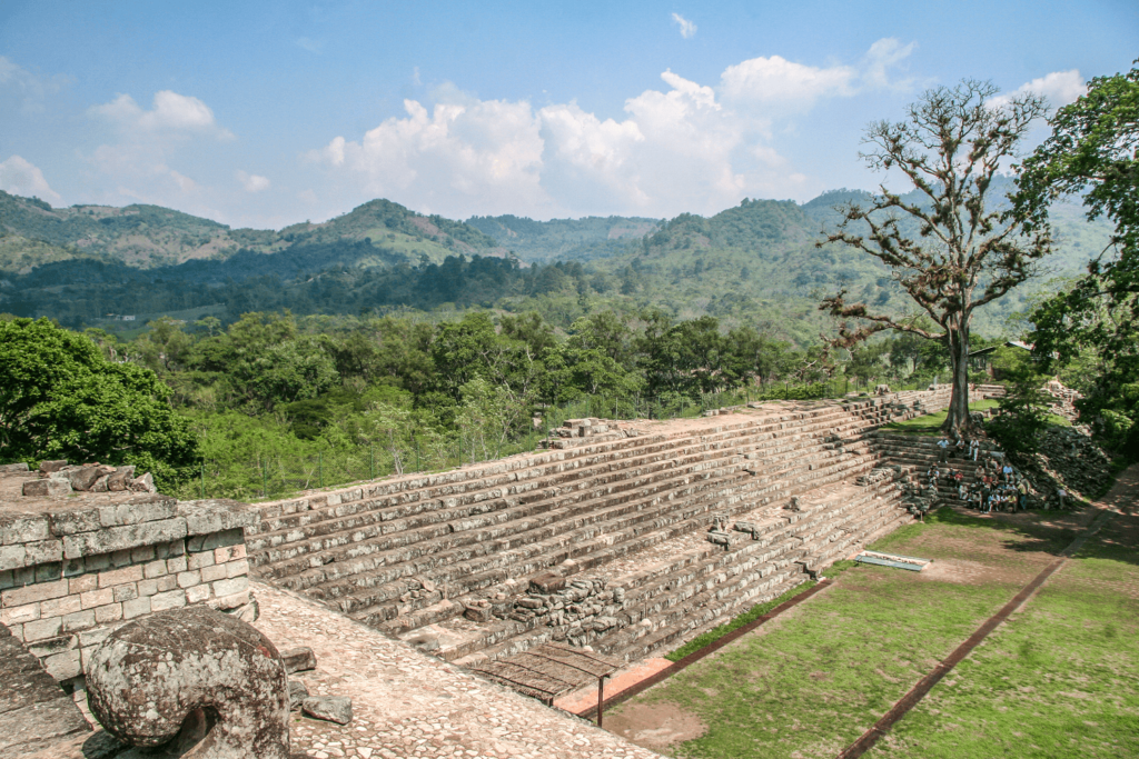
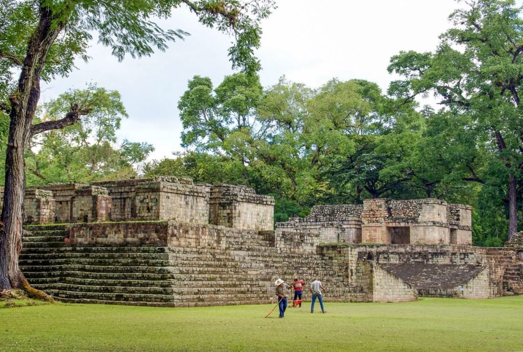
Yes, correct. That archaeological area, the main site as we call it today, is where we have the hieroglyphic staircase, the Acropolis containing the Rosalila building, the ball court, and the Great Plaza of the stelae. That was originally reported for the very first time by a Spanish explorer back in 1576 to the King of Spain. There was not much interest at that time. It was not until the 1800s, starting in the early 1800s, when explorers and archaeological missions started working on it.
And one of the unique features of Copán is that there are temples nested inside newer temples, and the tunnels that are accessible allow you to view walls of these earlier temples.
Correct. It is something you could do in Copán, and it’s one of the few sites where you can see this. But there’s something here, John: those tunnels were made by archaeologists as part of the archaeological work. They were not made in ancient times. Sometimes this connection is made because we see the pyramids in Egypt with tunnels and galleries inside and think Maya pyramidal temples are similar, but in reality, no. In this case, the very first archaeological projects were conducted between 1895 through the final creation of the archaeological site back in 1952. All of those works were dedicated to restoring the buildings and trying to stabilize the masonry still in situ. A lot of masonry was buried by large portions of the highest parts of the buildings. So by cleaning and restoring, they finished the work on the surface of the site and started trying to intervene in the interior of those pyramidal buildings, and this is when tunnels came about. There was evidence of constructive layers underneath what we were seeing at that time, and Carnegie Archaeological Mission back in 1940 made one of the first tunneling projects on the north side of Temple 11. They worked their way through it, documented an early staircase and an early temple inside—there’s a funeral chamber inside, by the way. Later on in the 1980s and 1990s, nearly 4 kilometers of tunnels were made by different archaeological missions. So those are the tunnels you see today. Copán is one of the few sites where you can actually visit the tunnels and see the type of work archaeologists conducted in the interior, and see masonry of buildings that easily predate by a couple of centuries the buildings you see on the surface. That makes Copán very special.
Were these changes made to the existing pyramids because of dynastic changes or changes in religion?
Well, primarily these changes were made to adapt the infrastructure to the demands of the city. One thing to understand is that the major Maya kingdoms of the Classic period came about through decisions made unconsciously over a very long period of time. They were not really planned cities. What we see is the progression of very early settlements—dating back to 1500 BC in the Copán Valley—that started to master agriculture. They started to increase their agricultural output little by little, gathering more people and becoming attractive to bands moving through that saw Copán growing up and joined them. As the population grew, the demand for infrastructure for administrative and religious purposes also grew, and this is when more recent kings decided to dismantle previous temples and make new ones. But we see a constant line where their religious beliefs were retained. The newest buildings were just bigger, more elaborate versions of the previous ones. Sometimes they actually reused square blocks of previous buildings, and sometimes stone carvings were embedded in a newer version like relics of previous temples exposed in the new ones.
You know, we’ve spent some time in Egypt and we saw the temples there. It was mostly erasure of the previous dynasty and replacement with the current kings. But that’s not the case in Copán.
Not necessarily. For some kings, it was really very hard to make a newer version of a temple, especially if they ruled for short periods of time. One thing kings did do was discard monuments depicting previous rulers. That was a tradition all over: Maya kings ceremoniously terminated depictions on stelae and altars of the previous king and buried them, so the new king would have a clean canvas in the city landscape to start adding his own. That is something that also happened among the Maya.
So Copán’s function was primarily agricultural. Is that how it began? And it must have changed over time.
The origin of Copán, with occupation going so far back, was surely agricultural. But at the peak of development during the 8th century AD, Copán was no longer a farming society. Copán was occupied by a society that was highly specialized and deeply stratified—masons, stone carvers, weavers, bureaucrats, architects. Evidently Copán was not self-sustainable. Copán needed a farming periphery, and this is where Quiriguá started to play a very important role. Quiriguá, which as the crow flies is about 50 kilometers north of Copán, became the major food provider for Copán. Copán was sponsored by the agricultural production of Quiriguá. So Copán lost its agricultural essence and became a major urban center that had a huge area under economic and political control.
Yeah. The level of the stonework at Copán is, I think, unmatched in anything I’ve seen in the Mayan world, up into Chiapas, the Yucatán, across Belize, Guatemala, and El Salvador. I’ve never seen anything as beautiful as what I’ve seen in Copán.
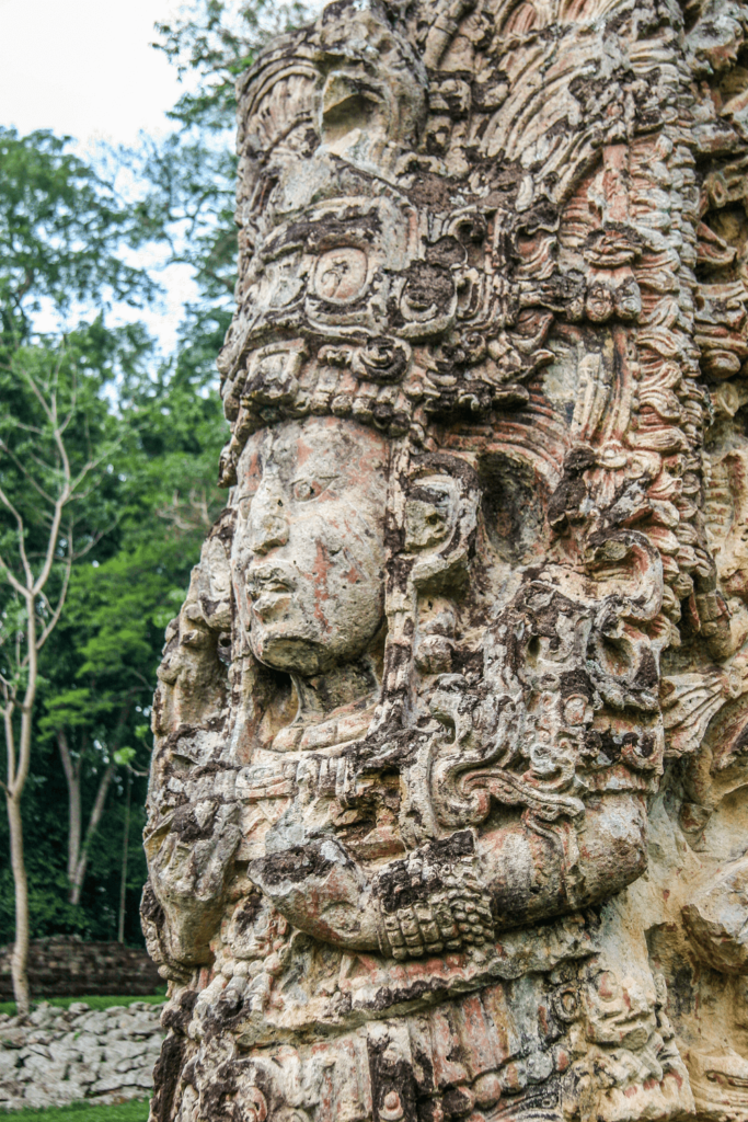
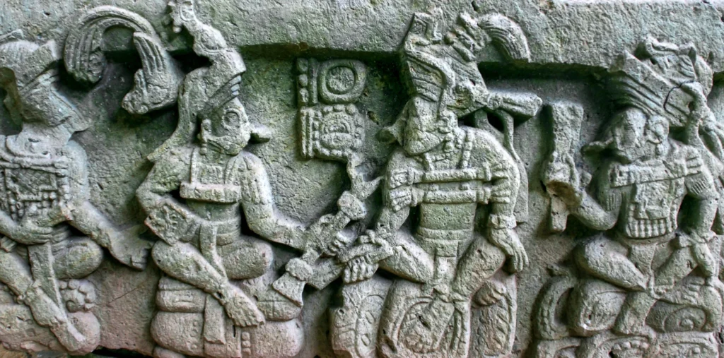
You’re right. It might sound like a very biased opinion because I’m from here, but leaving my heart aside, I agree with you definitely. And I would go beyond: I think that in pre-Hispanic times on our continent, there was nothing comparable to the stone carving in Copán—the three-dimensionality, the richness of details, and that artistic obsession for leaving no blank spaces. It actually has no match on the whole continent. Although there are other Maya sites whose carving I love and that rival Copán, like Quiriguá—Quiriguá’s stone carving is also spectacular, the size of the hieroglyphics on their monuments is amazing, with beautiful calligraphy there. Also the site called Piedras Negras in Guatemala near the border with Mexico. Those sites rival Copán in stone carving.
It’s true what you say about the three-dimensionality and expressiveness when I think of some of the stelae in the main plazas in Copán—and you see this in Quiriguá as well. The delicacy of the gestures of the hands especially is remarkable.
Yes, on a couple of their monuments you can see that the stone carver was depicting the king in a very gracious, very natural way, looking as if stone carvers of Copán were capable of making a fully round standing image of the ruler. There are a couple of them that were just a couple of inches away from going all the way around the legs depicting the full roundness, but they didn’t do it—maybe because they needed a board on the back for the hieroglyphic inscription. Otherwise, they might have been able to make an image like Michelangelo’s David.
Which stelae or monuments are your favorites at Copán?
It’s very hard to choose one. I have several carvings I like. The quality of Stela H is really spectacular—I love the depiction of the king, the beauty of it, the religious iconography, and the mythological characters embedded together. But I like Altar Q as well. Even though Altar Q is not the prettiest, the information it contains is so important in understanding the history of the city. Even though the aesthetic quality is not as impressive, I’d put it among my favorites. But if I have to choose only one, I’ll say Temple 22. It’s a temple that interestingly is mounted over a platform inspired by Teotihuacán, the ruined city northeast of modern Mexico City. That city exerted influence on Maya royal houses in early stages, and it was common for Maya royal families to show affiliation with Teotihuacán. Temple 22 is one of them, although while the bottom is Teotihuacano, the upper part is pure Maya. The iconography declares the place to be a man-made mountain where humans have the chance to interact with divinities, done in an exquisite way. There are nearly 2,000 stone blocks that were carved individually to make the huge composition of the facade and roof comb of that building. That was one of the most spectacular temples at its time in the whole Maya world. That would be my favorite by far.
When I think of the iconography of Teotihuacán, when I think of jaguars, are they evidenced in Copán?
Interestingly, there are some jaguars in Copán and icons associated with Teotihuacán. One of them is the so-called “goggle eyes”—circles around the eyes used by people showing affiliation with Teotihuacán.
When I think of the statues I’ve seen of Copán’s first ruler, he has those goggle eyes.
He has that exactly! He appears depicted with those characteristics on the altar in his funerary temple, and on the last of his funerary temples. He appears wearing that. There are also pottery pieces, incense burners depicting him in that fashion, and carvings on the famous hieroglyphic staircase. That’s one of the icons clearly making a connection with Teotihuacán as well.
What do we understand or translate on the hieroglyphic staircase?
This is a very interesting monument. Sadly, the monument was found almost entirely collapsed, and there was no way to reconstruct the original sequence of the text. Back in 1895, only the first 15 steps were in situ. Later, archaeological projects made a reconstruction of the whole hieroglyphic staircase, so it’s very hard to read. Another challenge is that the mortar used for the reconstruction project had a corrosive effect on the stone, destroying most of the hieroglyphic inscriptions. So it is challenging to decipher, but archaeologists using modern technology have a general understanding of the inscription, and it seems to compile great military episodes in the history of Copán. The reason why this monument was dedicated seems to be that the royal family was trying to step out of a very embarrassing incident: the death of their 13th king by the ruler of Quiriguá. The hieroglyphic inscriptions in Quiriguá celebrate that—they celebrate that the 13th King of Copán, their overlord, was abducted and killed in the year 738 AD. So it seems the successors of this beheaded king of Copán tried to revive the prestige of their family by dedicating a military monument depicting themselves in military garb for the very first time, changing the narrative of Copán artistry from rulers as divinities to rulers as warriors.
Fito, has LiDAR been used in Copán or in any other areas within Honduras, and have they made discoveries of additional sites or components of the city?
Yes, LiDAR was used in Copán some years ago, but the use of LiDAR in Copán didn’t really bring much new information. LiDAR shows all of its power and benefits in places where dense vegetation covers archaeological remains, like Tikal and the northern Guatemala peninsula. LiDAR revealed a lot of temples we didn’t know existed in that area. But in Copán, LiDAR didn’t reveal much new because Copán is maybe the best-mapped Maya site of all the Maya lowlands. There is a new technology being used in Copán—Copán is the first Maya site to use it—which involves devices measuring subatomic particles (muons) that can penetrate to considerable depth. Kyushu University’s archaeological project is placing tools to measure subatomic particles blasting through one of the buildings. By measuring that, we can make an X-ray image of the temple to see if there is a void or chamber, allowing us to intervene directly into the chamber rather than blindly trenching or tunneling as was done in the 1990s. That is state-of-the-art technology being used now.
The city flourished for four centuries, and then the collapse seems to have been fairly rapid. What are thoughts about what caused the collapse?
It is very interesting. Copán’s collapse seems to be connected to the death of the 13th king. When we analyze the history of Copán through artistic creations, we see that the reign of the 13th king—formerly known as “18 Rabbit”, though now we know his name should be 18 Times Cowil / Lightning God in Maya—ruled 42 years, and those years were the pinnacle of artistry. But surprisingly, immediately after his death, his successors really struggled to dedicate monuments in public. Whenever we see a reduction in the output and quality of art, it is the product of stress and crisis. We believe that since the 13th king was killed, allegedly by decapitation in Quiriguá, that was a heavy blow to the political structure of the city. The Copán royal family lost prestige and power. But the most important thing, John, is that Copán lost its biggest taxpayer. Remember, the little farming community that was successful here lost its self-sustainability when it became a city a millennium later. The city needed enormous amounts of resources and energy to sustain an urban population estimated at over 25,000 people. When you have such a large demand for resources and your nearest breadbasket, Quiriguá, turns its back on you, you’re in real trouble. So we believe the royal family couldn’t maintain sustainability. Archaeological evidence shows that the death of the 13th king was the watershed in the history of the city, and after he died, everything went into a steep decline.
So their military propaganda, their staircase building, didn’t win the day.
Exactly. That was like that very embarrassing press conference you have to give after a big mistake.
One of the most special memories I have from Copán is you and your connection to the macaws on site. Can you tell us about that?
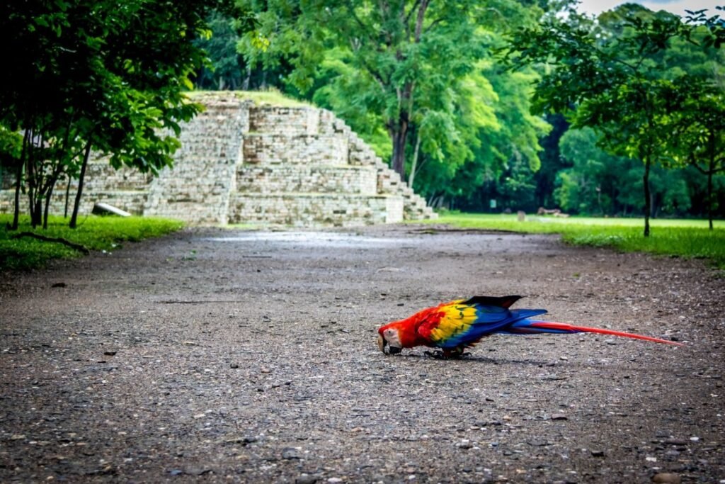
Oh, the Scarlet Macaws! Well, yes, Scarlet Macaws are spectacular. Most people visiting the ruins now go to see the birds first and then the ruins, rather than the other way around! I love birds—I’m not an expert birdwatcher, but I love them, and Scarlet Macaws are national symbols in Honduras. Beyond that, they appear often in mythological depictions in Maya artistry as an impersonator of the sun god. We have a healthy community of Scarlet Macaws living now in the Copán Valley. By the time you were here 20 years ago, the repopulation project was in its early stages. At this point, Scarlet Macaws have been reproduced in captivity from former pets, and their offspring released into the valley. We have more than 200 Scarlet Macaws living in the Copán Valley now, and we have a third generation of Scarlet Macaws born in the wild. The project is very successful—they are everywhere nowadays.
They’re a little noisy.
Yeah, a little! Nature is very fair, you see: beautiful birds have very ugly calls, and dull-colored birds are great singers!
What are some of the most special memories you remember in your many visits to Copán with travelers?
There’s something I witnessed that was a very special occasion. It was in 2012—maybe you remember the so-called Maya prophecy end-of-calendar year. There was a time when the archaeological site was open for visiting during the nighttime, which has occurred in Copán only twice in history. For that occasion, a couple who had met while traveling came back to Copán as the place where their love story started, and they actually got married in the Acropolis of Copán. It was conducted by a Maya spiritual leader. That’s something I will never forget—it always comes to mind as something very special.
If people want to understand more about the Copán Valley and Maya culture, are there books you would recommend?
Yes, several! Maybe the best book to start getting acquainted with Maya culture is The Maya by Michael D. Coe. I recommend it because it starts with descriptions of landscape, flora, and fauna, and little by little goes into the depth of Maya civilization and how complex features evolved, including a section dedicated to Copán. It’s fabulous to read, not full of thick technical jargon. Another book I recommend to understand the Maya in general and Copán is a translation of the Popol Vuh, the ancient Maya book of creation found in Chichicastenango, Guatemala. The translation I highly recommend was done by Dennis Tedlock from SUNY Buffalo. It’s a fantastic book connecting Maya agriculture, mythology, and ball courts as playing a crucial role in daily life. And to understand the stonework and iconography of Copán specifically, the book Sculptures of Copán by Barbara Fash, which has up-to-date information about iconography and stone carving.
When I think of visiting Honduras, Copán is always high on my list. Are there other locations in Honduras you think shouldn’t be missed?
Honduras offers a very good variety of nature. Archaeological sites beyond Copán are modest, but you can visit national parks with great trails—along the north coast in the area of Pico Bonito, for instance. Lake Yojoa has also been upgraded in infrastructure with national parks and community members offering ecolodges and local guides, especially for birdwatchers. Honduras also offers the Bay Islands on the barrier reef, such as Roatán, Utila, or the Cayos Cochinos on the north coast—beautiful places that make a great combination with Copán. The central highlands also offer Maya-Lenca communities that are very picturesque, where you can see countryside life isolated from modern development.
You have a beautiful country. I’ll always have good memories of sitting with you and my family overlooking the river from Hacienda San Lucas in the evening while the sun goes down, or visiting the bird park with my children. Thank you for those memories. My kids still argue about who deserves the stick you gave them—you offered them a stick with a macaw feather on top, and that was a coveted treasure for my girls.
Wow! It’s amazing to realize that was 20 years ago and they are all grown up now.
They’re all grown up. Thank you, Fito. Thank you for the visit and your kind words.
It really makes me happy to see that you have these memories of my town, the site that I love so much, and of me. So thank you very much.