Page Menu
Aysen: Chilean Patagonia
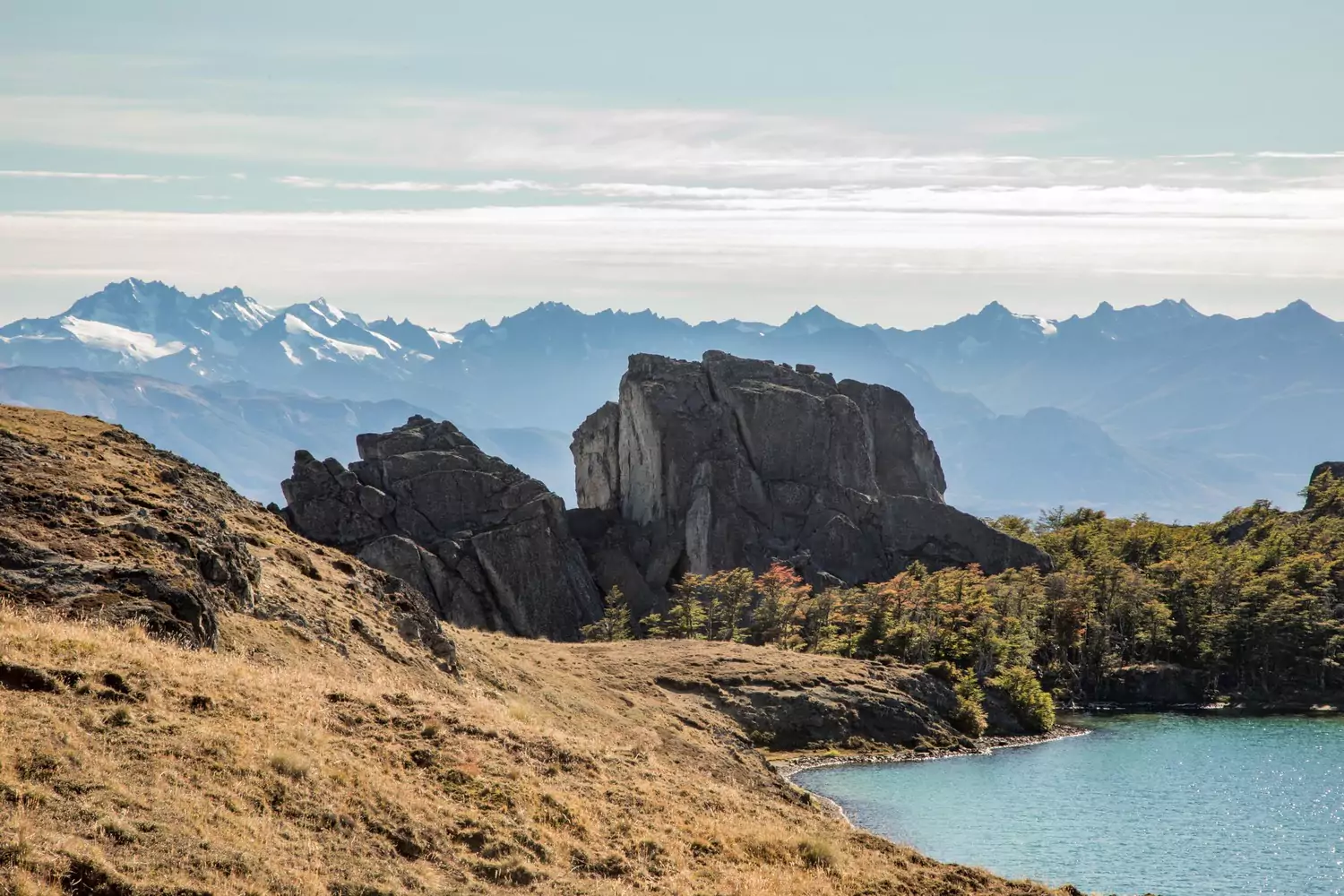
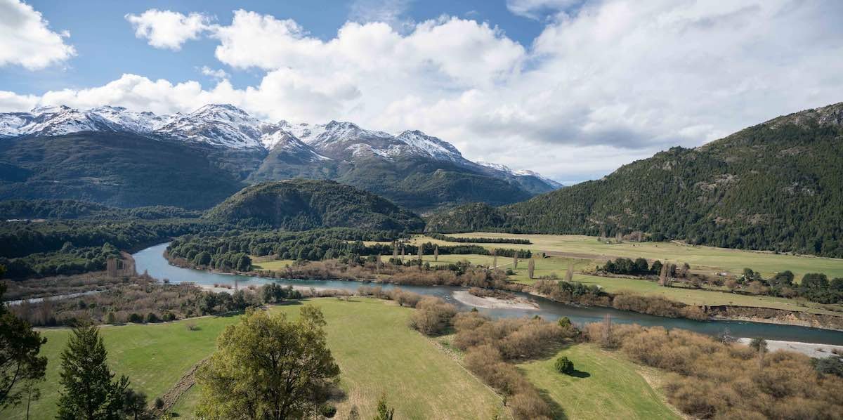
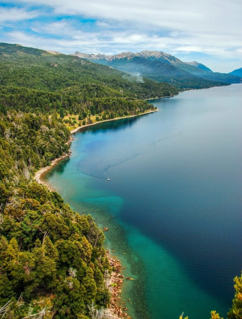
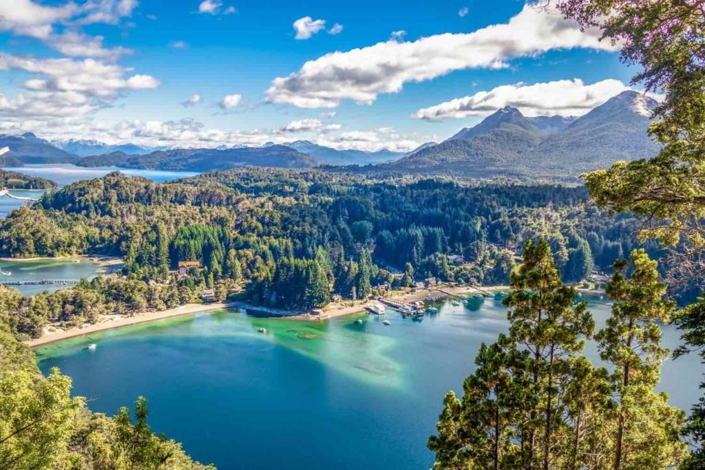
The remote region of Aysen encompasses a massive section of Chilean Patagonia. This is the least populous of Chile’s fifteen regions—a wilderness of fractured coastline, fishing villages, and steep mountainsides. Between Puerto Montt in the north and O’Higgins to the south, the Carretera Austral Longitudinal crosses roaring rivers and twists through primordial rainforest.
Along the 770-mile route, you’ll pass seven national parks and protected areas, including Pumalin and Laguna San Rafael. This may be the wildest road trip South America has to offer. Car rental and private transfers can be arranged. Aysen (also Aisen) is an ideal destination for outdoor adventure and active pursuits.
Chile’s Route 7: Patagonia’s Perfect Road Trip
For years, I’d wanted to explore the Aysen Region (and southern portion of the Lagos Region) of Chilean Patagonia by road. Air travel can save time, but to really understand a country, go by land. Give yourself time to explore, adventure, and encounter. Prepare, but let go. This is that kind of territory.
Like Argentina’s Ruta 40, Chile’s Ruta 7 links a vast section of diverse landscapes—770 miles from Villa O’Higgins in the south to Puerto Montt in the north. First conceived in 1976, Ruta Siete has been under seemingly endless improvement ever since.
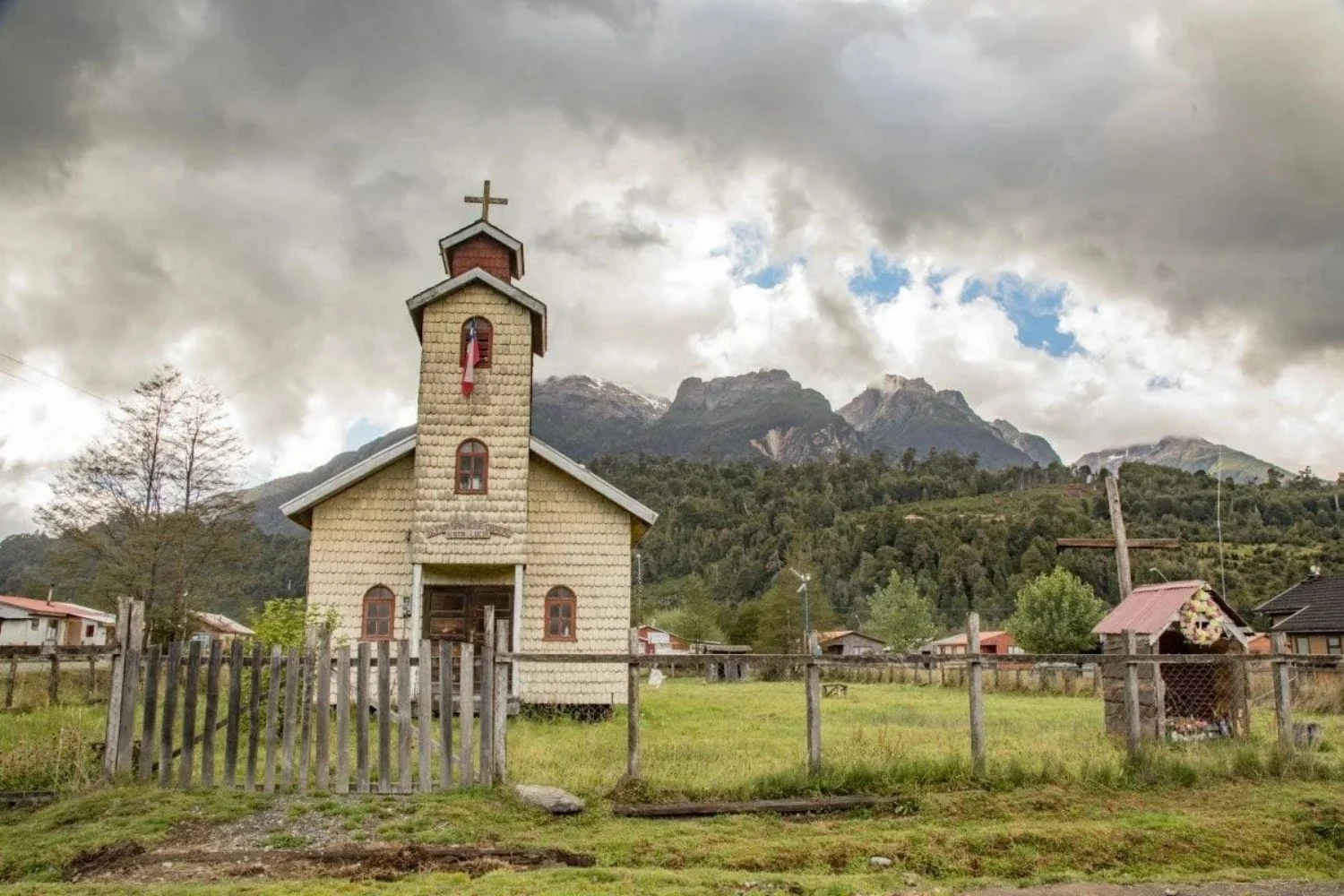
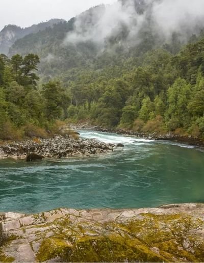
Its current configuration is an incongruous jumble of drift-able gravel, flour-fine dust, potholed tarmac, and perfect concrete. Road materials can change three times within a mile, demanding concentration. The route’s unifying themes are beauty and surprise. In some sections, I found myself habitually compelled to stop and savor.
Estimated drive times became meaningless; I was here to enjoy the journey, and this landscape delivers all the beguiling highlights: golden meadows, soaring peaks, misty rainforest, and Windex-blue lakes. Route 7 travelers pass through Montana, Switzerland, Oregon, New Zealand, and Gondor. Often in the middle of empty highway, I slowed to a stop to inhale the moment and place, making them part of me.

I’d rented a six-speed four-wheel drive in Balmaceda, Route 7’s southernmost airport with regular commercial flights from Santiago. Balmaceda isn’t much more than this airport, which serves the town of Coyhaique, an hour to the northwest.
I checked the tires, studied the jack, acknowledged the lack of cell phone service, and sorted my playlist. My plan was to drive to the limits of Route 7, first south, then north, and then back again to Balmaceda. Doubling back on most of the route was additive to the experience; drive it both directions, and you’ll be nonplussed by how much you missed.
The territory crossed by Ruta 7 made international news in January 2018, when Tompkins Conservation formally transferred one million acres (Parque Pumalin and Parque Patagonia) to the Chilean people–the largest ever donation of land from a private entity to a country. As part of that agreement, Chile’s government set aside another nine million acres as national park land. In combination with existing parks, these regions will now have 17 national parks—vital, largely contiguous north-south and east-west wildlife corridors.
With these parks in place, Route 7 becomes more than storied Patagonian open road. It is being reborn as a conduit to world-class protected wilderness. By visiting, you can reaffirm Chile’s wisdom in preserving these areas.
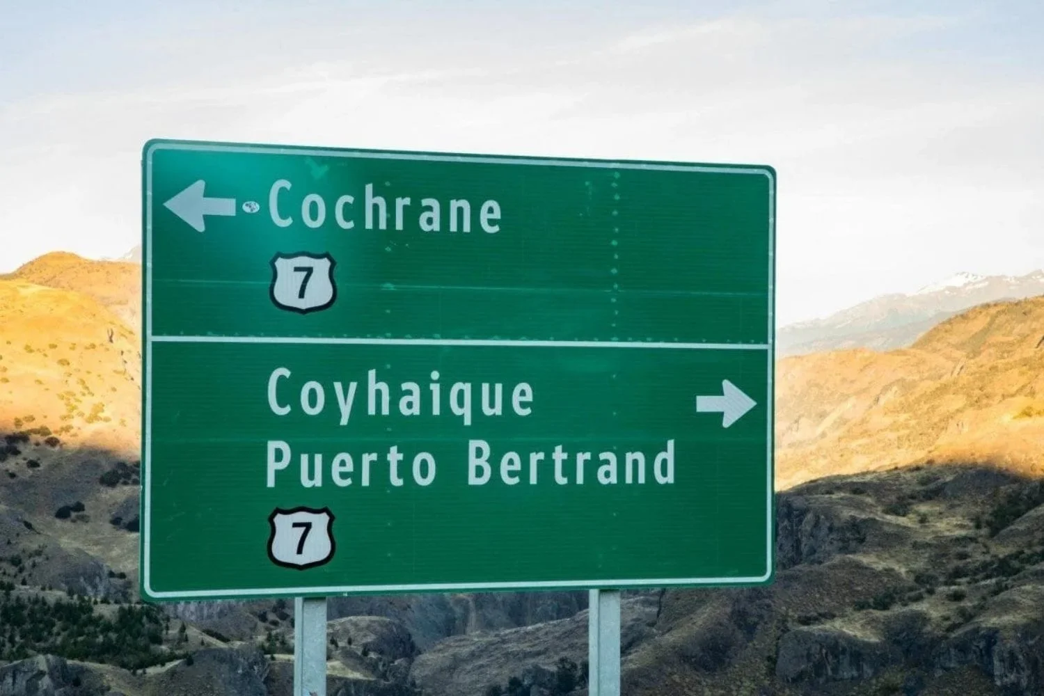
The major segments (roughly south to north) are as follows *:
- O’Higgins to Cochrane – 146 miles (7 to 8 hours)
- Cochrane to Puerto Tranquillo – 71 miles (2.5 hours)
- Puerto Rio Tranquilo to Villa Cerro Castillo – 76 miles (3 hours)
- Villa Cerro Castillo to Coyhaique – 60 miles (90 minutes)
- Balmaceda to Coyhaique – 35 miles (one hour)
- Coyhaique to La Junta – 172 miles (5 to 6 hours)
- La Junta to Futaleufu – 90 miles (3 to 4 hours)
- La Junta to Chaiten – 90 miles (2 hours)
- Chaiten to Caleta Gonzalo – 35 miles (1 hour)
- Caleta Gonzalo to Vodudahue / Leptepu – 6 miles, after the short ferry across the channel (variable time)
- Vodudahue / Leptepu to Hualaihue – 35 miles, after the long ferry across from Leptepu to Hornopiren (variable time)
- Hualaihue to Puerto Montt – 52 miles total, and a ferry across the Estero Reloncavi (variable time)
* Distances and drive times are approximate. If the road ahead has construction, you might need to pare for 30 minutes several times to let opposing traffic pass.
Along Ruta 7, filling stations are rare. If you see a fuel stop, take it! Make sure your rental has a full tank when you pick it up (LANDED can, of course, help you with flights, accommodations, and guides). Fuel is available in these locations:
- Cochrane
- Villa Tranquilo
- Coyhaique
- Villa Maniguales
- La Junta
- Futaleufu
- Palena
- Chaiten
- Puerto Montt
Route 7 Highlights
Questions I had answered on this journey:
- Is it possible to drive from Torres del Paine to Puerto Montt within Chile?
- No. In Chile, the road (Ruta 9) doesn’t exist from Torres del Paine to Villa O’Higgins. Instead, one can cross the border into Argentina at Rio Don Guillermo and drive north roughly 500 miles on Ruta 40, crossing back over into Chile at the Chile Chico crossing south of General Carrera Lake / Lago Buenos Aires. If you do this, be sure to head south to visit Parque Patagonia.
- How original would it be to ride Route 7 by motorcycle of bicycle?
- Hundreds of each type of rider are on the road every day. The most impressive? The parents, who do it with children in bike seats. I saw three separate families in one day north of Queulat National Park. The kids were smiling beneath their ponchos. That’s top-notch parenting.
- Should I stop and buy fuel?
- Every single time.
- Should I make this trip again?
- So, I planned to come back with my family three months later.
Kristine and Douglas Tompkins first came to the Chacabuco Valley in 1995, and soon began dreaming about how to conserve it permanently. They purchased the over-grazed land in 2004, began rewilding it, and finalized its donation to the Chilean government in 2018.
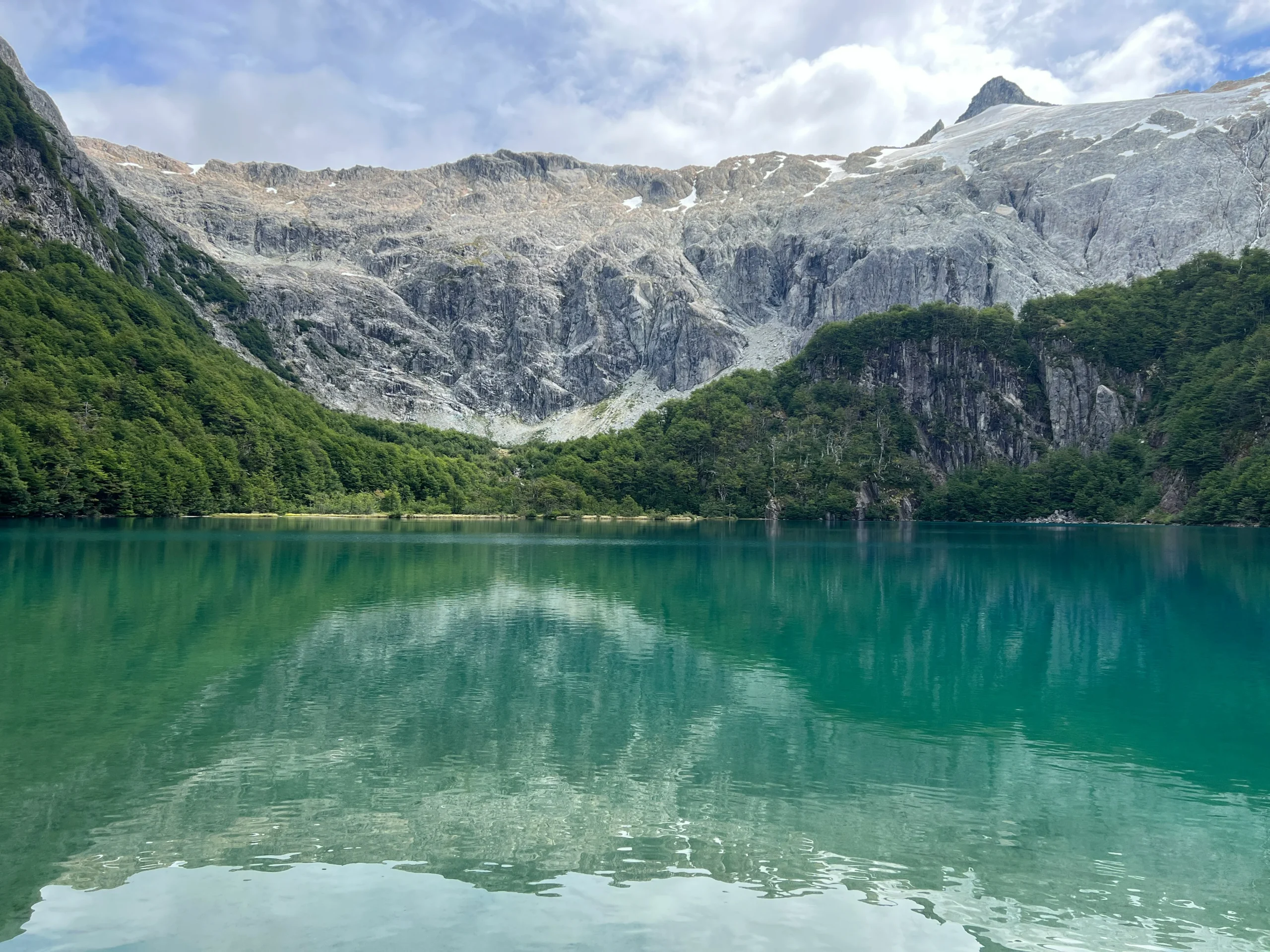
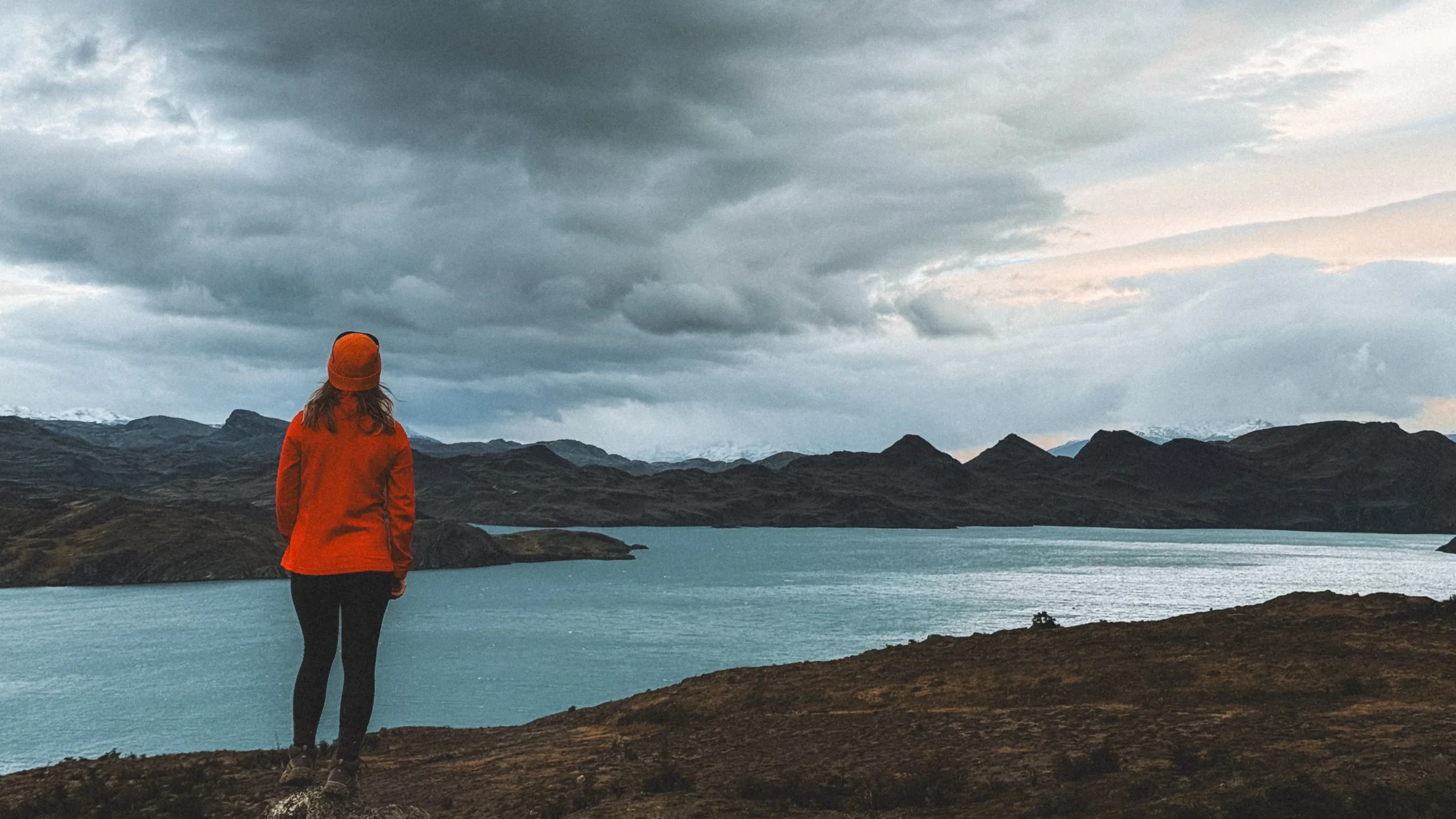
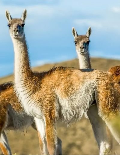
Why come? To roam among the ice fields, Southern beech forests, mountain lakes, and hauntingly beautiful steppe. To encounter a living, whole ecosystem—one wild with guanacos, flamingos, pumas, foxes, and rheas. To stretch your legs and your soul. To gain elevation and perspective. I could have stayed here longer, and I’m sure I’ll return.
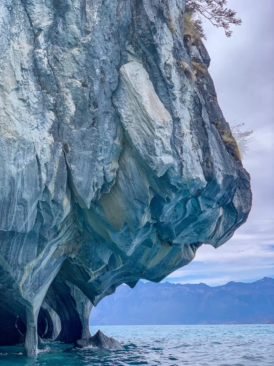
Almost 600 square miles of lush Valdivian rainforest–the only temperate zone rainforest in South America. Mist and rain are combed from these skies to form streams and waterfalls, nourishing ancient trees and a dense understory of bamboo, ferns, umbrella-sized nalca (giant rhubarb).
These woodlands are inhabited by pudu (miniature deer), wild boars, opossums, huemul (South Andean deer), and hummingbirds. On clear days, you can observe Andean condors riding the thermals above the forests and cliffs.
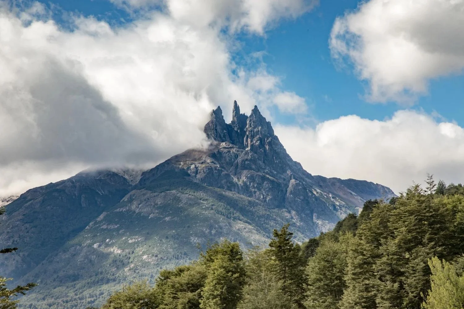
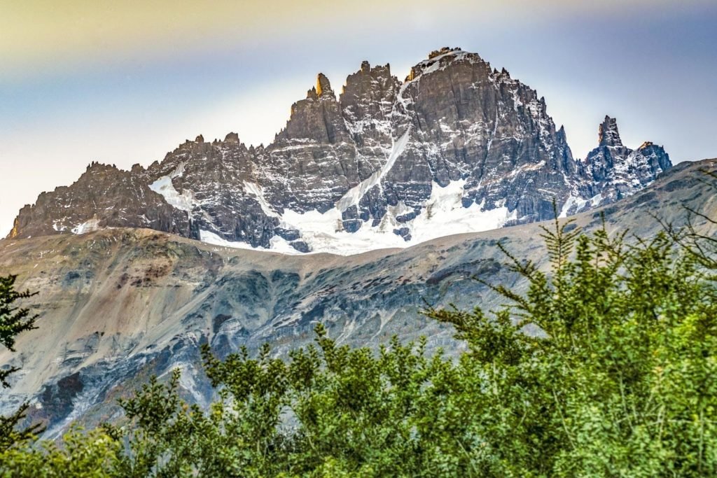
Weather permitting, hike to the viewpoint of Queulat Glacier, which hangs from the mountaintops and feeds waterfalls and icy-green lagoons.
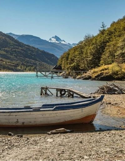
Time travel to Jackson Hole circa 1950, and subconsciously start shopping for retirement property. Futaleufu is (for now) a classic mountain town with world-class river running and fishing.
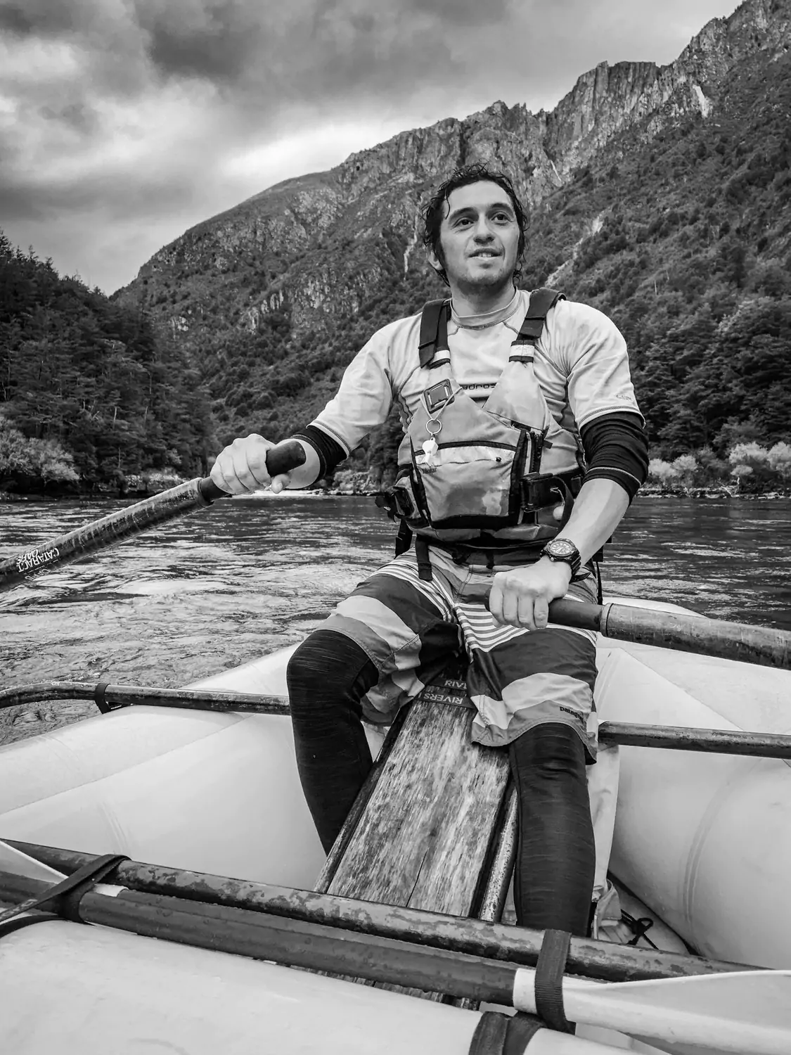
The region’s main river is the powerful, glacial-blue Futaleufú—big river in the Mapuche tongue—one of the top five rivers in the world for whitewater sports. The trekking and fishing are also world class. The craggy peaks and ancient forests are rarely visited, compared to other parts of Patagonia. Anglers come seeking monster King (Chinook) salmon and trout.
Class IV and V rapids are easy to come by, and you will need to hold on tight. Yes, that is the real color of the water—totally unfiltered.
Palena, near the Argentine border, is a well-known secret among anglers, who come to target brook and rainbow trout in the Palena and Malito rivers, east of the Nevado Massif.
Valle California, 40 minutes from Palena, is largely protected as a private reserve with perpetual conservation easements. Visitors can fish, hike, and ride the territory with native gauchos.
Corcovado is a landscape drawn from the dreams of explorers, backpackers, and climbers. The panorama sweeps from the sea to coastal rainforests and more than 80 lakes.
In the northern portion of the park, eyes are drawn upward to the icy edges of Corcovado Volcano—the peak attempted in the 2010 film 180 Degrees South: Conquerors of the Useless. The park is home to marine mammals, penguins, shorebirds, native deer, and pumas.
North of Corcovado, Parque Pumalin has a well-defined trail system, allowing access to coastal rainforest, waterfalls, volcanos, alpine lakes, and grand overlooks. Many of the trails can be completed in three hours or less.
Favorites include the Sendero de Alerces (an easy loop through an ancient grove of Alerce trees) and the 3.5-mile Cascada trail through Valdivian rainforest.
More than 180 square miles of ice, mountains, rivers, and forest near the feet of the Yate and Hornopiren volcanos.
This is two parks in one: the eastern side is covered in glaciers and rocky slopes, while the western portion is cloaked in blue lakes and rivers, lush rainforest, beech and Alerce woodlands, and golden grasslands.
Favorite hikes include the trail to Lake Pinto Concha (with clear views of Yate Volcano) and the short walk to Rio Blanco Waterfall.
Persistent mysteries:
- Where do all the road workers commute from?
- How did I not fishtail off that cliff between Puerto Rio Tranquilo and Lago Bertrand?
- Why are all the bridges orange?
- If all these hitchhikers set out to hike Ruta 7, why don’t they want to hike?
In the weeks since my road trip, deeper questions have come to mind. Why do we need open road? Where do planning, spontaneity, and freedom meet? Why am I so drawn to wild places and so haunted by them when I’m away?
I’m looking forward to exploring this region for years to come. Chile has the land, and seems to have the will, to make its new park-to-park Ruta de los Parques a world-class conservation destination.
Chile, I’ve known you for years. I think you’ll succeed.
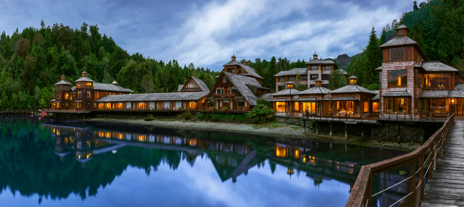
Our Favorite Hotels


What to do in the Aysen & Magallanes
The outdoor adventures in the Carretera Austral showcase Patagonia’s rugged terrain and remote wilderness. The region offers a wide range of activities for adventure seekers. Visitors to Aysén can enjoy:
- Hiking
- Whitewater Rafting
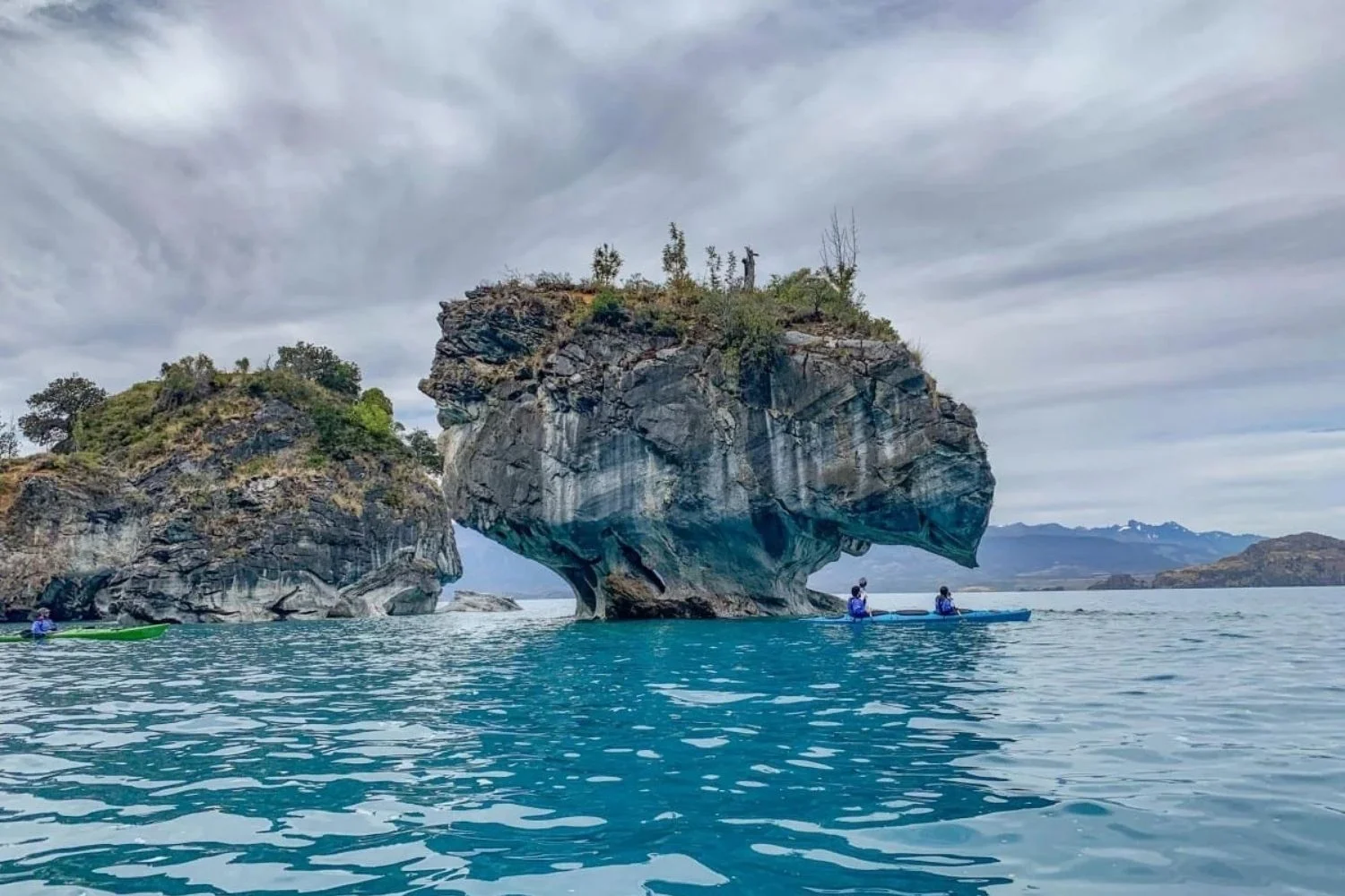
- Kayaking
- Canyoneering
- Horseback Riding
- Exploring Blue Lagoons and Caves
- Wildlife Watching and Birdwatching
- Enjoy views of Fjords, Glaciers, and Snow-Capped Peaks
What is the Weather Like?
Chilean Patagonia experiences a dynamic climate with significant seasonal variations. Summer months, from December to January, bring the warmest temperatures, with daytime highs reaching 65°F and nighttime lows around 40°F. Winter, from May through August, is marked by fleeting daylight, daytime highs near 40°F, and freezing nights.
Precipitation varies significantly throughout Route 7, the closest you are to the ocean the more rainfall you’ll encounter. Meanwhile, destinations closer to the Argentinian border have light precipitation year-round. Visitors should be prepared for rapidly changing weather and dress in layers to ensure comfort throughout their journey.
No matter when you visit, the weather in this area can surprise you. These averages are changing, please check extended weather forecasts using your favorite weather app prior to departure.
Getting There
If doing a Carretera Austral road trip, guests usually choose to rent a car in either Coyaique or Puerto Montt. Both destinations can be reached by air from Santiago. Puerto Montt also has direct flights from Puerto Natales and Punta Arenas, easily combining this destination with Torres del Paine. Where to fly in will depend on what destinations you are looking to visit and how many days you are looking to travel.
Small commercial aircraft connect Puerto Montt with Chaiten. Private transfers can be arranged from here to hotels in the Northern section of Carretera Austral. Most town also have its own airstrip. LANDED can assist arranging private charters.
Start your journey today
LANDED delivers the finest in custom, private travel to Central America, South America, and Antarctica. These regions are our passion; we know them first-hand and by heart. Speak with one of our travel designers and let us create a tailored itinerary for you in Route 7.
How to combine Route 7
Have some extra time? Here are some options for you to combine with.

