Choquequirao

ACTIVITIES

WEATHER

GETTING THERE

COMBINE WITH

Choquequirao

Deep in the Salcantay Mountains, a fortified hilltop city rises above the Apurimac River Valley. Now known as Choquequirao (Cho-kay-key-raow; Quechua for Cradle of Gold), this city was likely constructed in the mid-1400s under the reign of Pachacutec, the same Inca responsible for the construction of Machu Picchu. For roughly a century, Choquequirao served as an administrative complex, a commercial and military gateway to the Amazon Region, and a ritual center.

In the 1530’s, the city sheltered the army of Manco Inca Yupanqui during his fight against the Spanish. Although Choquequirao was stumbled upon by a few Europeans in the 1700s, it wasn’t widely-known until Hiram Bingham visited the site in 1909. Excavations began in the 1970s. To date, only around 60% of the site has been uncovered.

San Pedro Claver
Choquequirao crowns a hilltop (Sunchu’u Pata), 10,100 feet above sea level. Like Machu Picchu and Bolivia’s Incallajta, Choquequirao mirrors the symbolic patterns of Cusco, the imperial capital. Its ritual infrastructure includes sacred spaces dedicated to ancestors, sun, earth, water, and other divinities.
San Pedro Claver

How to Experience Choquequirao

Choquequirao can be reached with a two-day trek from the Cusco area. Our recommended roundtrip journey is five days and four nights:

Day 1: Cusco, Cachora, and the Apurimac River

Depart Cusco by van, heading north towards Abancay. Cross into Antapampa, enjoying breathtaking views of snowcapped Salcantay and Humantay. As you leave the pampas, mounts Pitusiray, Chicon and Veronica come into view. Descend into Limatambo and visit the Inca site of Tarawasi, continuing to the Apurimac River and cross the gorge. Near the village of Curawasi, visit the stone map of Sayhuite. Cross the bridge and descend to the village of Cachora, where your trek begins.

Carrying your daypack (porters and mules carry the camp gear), hike along the edge of Capuliyoc Mountain. Here you gain your first look at the Apurimac Canyon and its trail system. Descend to the campsite at roughly 8,000 feet above sea level. Today’s hike covers approximately five miles (four to five hours).

Day 2: Apurimac River to Choquequirao

Begin the day’s hike crossing the Apurimac footbridge, before making the long ascent to Marampampa—the meadow where you’ll rest for lunch. The afternoon portion of the ascent is not as steep. Tonight, you’ll camp in the cloud forest near Choquequirao. Today’s hike covers approximately 4.5 miles (seven to eight hours).

Choquequirao3
Day 3: Choquequirao to Marampampa

Today you’ll embark on an in-depth exploration of Choquequirao with your expert guide. Spend the morning visiting the central complex. In the afternoon, examine the outlying buildings and walk through the terracing. Some of these terraces are decorated with white stones, forming the shapes of people and animals. After lunch, descend to the campsite at Marampampa. Today’s hike covers approximately 1.5 miles (approximately two hours).

Day 4: Marampampa to Cocamasana

Begin your descent toward the Apurimac River, stopping to enjoy lunch in the canyon. In the afternoon, head back uphill, towards Cachora. Tonight, you’ll camp at Cocamasana, taking in spectacular views of the canyon. Afterward, begin your descent towards the river, stopping for lunch at the bottom of the canyon. Today’s hike covers approximately 3.7 miles (six hours).

Day 5: Cocamasana, Cachora, and Cusco

Start the day with the final ascent to Capuliyoc. Afterward, the trail to the village of Cachora is relatively easy. There, you’ll be met by the vehicle that will return you to Cusco. After a four-hour drive, you’ll arrive in the early evening. Today’s hike covers approximately 2.5 miles (three to four hours).

Choquequirao4

Guided Treks and Camping

A shorter version of this trek can also be arranged. Our treks include expert guides, cooks, porters, pack animals, meals, snacks, drinking water, tents and camping mattresses.

Sleeping bags can be provided for an additional fee, although most of our clients prefer to bring their own.

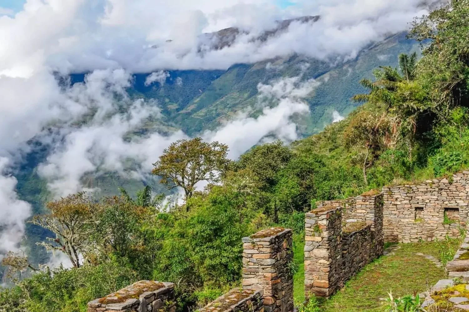
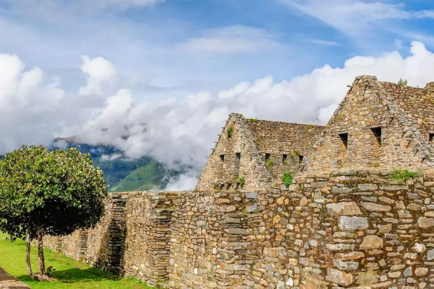
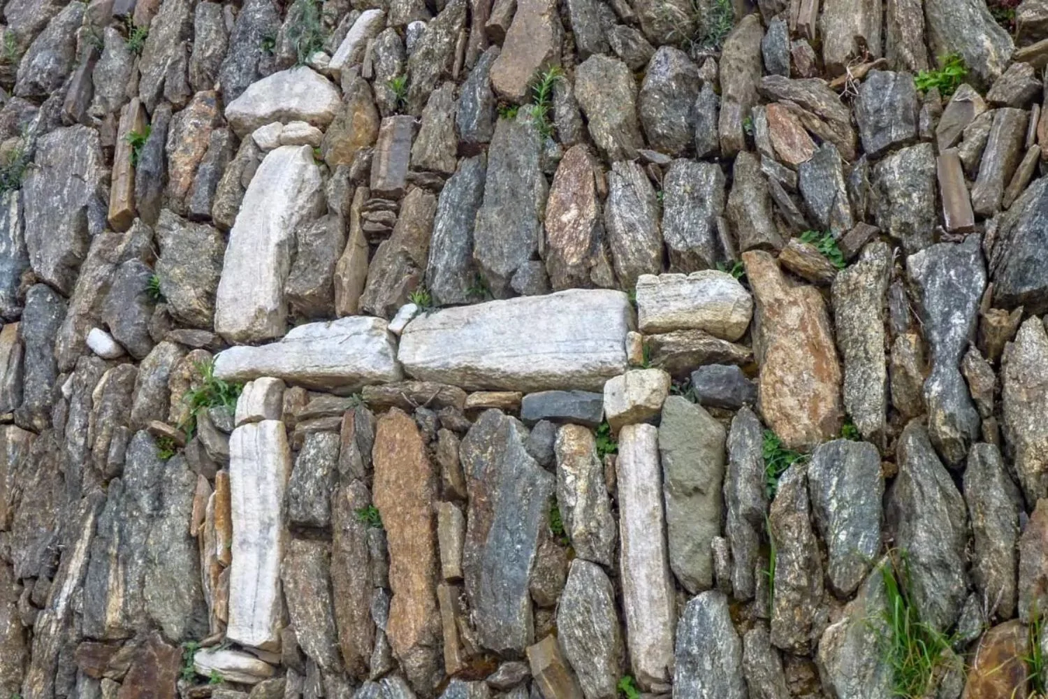
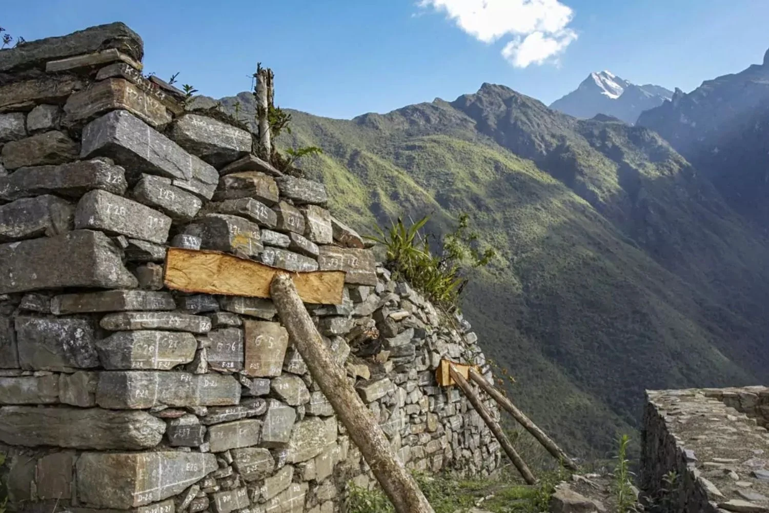
The central square is ringed by a temple, houses of elites and administrative buildings. From the central square, Choquequirao expands outward into a larger residential sector with storehouses, walls, aqueducts, and ingenious agricultural terracing.

Choquequirao5

What is the Weather Like?

As in most Andean regions, this region features a dry and wet season. The wet season starts around December and ends in March and the dry season makes up the rest of the year.

Choquequirao is located in high altitude semitropical forest. The region’s temperatures vary depending with altitude and season. During the rainy season, the average maximum temperature in Choquequirao is 73°F with a minimum of 50°F. The dry season experiences similar maximum temperatures but a lower average minimum of 42°F.

These averages are changing, please check extended weather forecasts using your favorite weather app prior to departure.

Choquequirao6

Getting There

The closest airport to Choquequirao is in Cusco, where we recommend staying before beginning your trekking journey. Cusco is an hour and twenty minute flight from Peru’s capital, Lima.

Start your journey today

LANDED delivers the finest in custom, private travel to Central America, South America, and Antarctica. These regions are our passion; we know them first-hand and by heart. Speak with one of our travel designers and let us create a tailored itinerary for you in Peru. 

How to combine Choquequirao

Have some extra time? Here are some options for you to combine with